
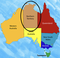
1. Where is it?
The the abbreviation for the Northern Territory is 'NT'.
The slogan for the Northern Territory is 'The Top End'. |
|
2. State or Territory?
Why is it a territory and not a state?
Territories are almost the same as states, with their own parliament. However, any laws passed in a territory parliament can be overruled by the Australian Federal Government. The Northern Territory wasn't made a state because it is so remote.
Territories are almost the same as states, with their own parliament. However, any laws passed in a territory parliament can be overruled by the Australian Federal Government. The Northern Territory wasn't made a state because it is so remote.
3. Symbols

The flag was first flown in July 1978. The white stars represent the Southern Cross. The Desert Rose on the red ochre panel has seven petals with a seven-pointed star in the centre, symbolising the six Australian states and the NT.
The official colours of the Northern Territory are black, white and ochre. 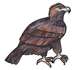
The official bird is the Wedged- Tailed Eagle.
|
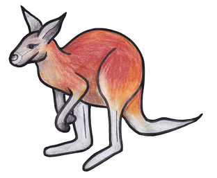
The official animal of the Northern Territory is the red kangaroo.
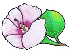
The State flower of the Northern Territory is Sturt's Desert Rose. It grows on stoney slopes requiring very little water.

The official colours of the Northern Territory black, white and ochre.
|
4. big things
|
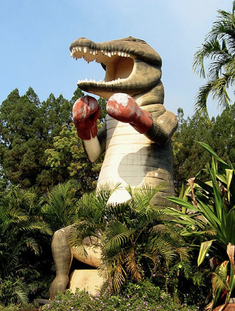
The Big Boxing Croc is located in Humpty Doo, outside the Bush Shop and service station in 1988. He is 13 metres tall and built to withstand cyclones. |
|
|
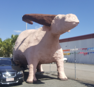
The Big Buffalo is a pink coloured Territory Buffalo, located in Winnellie at the entrance to Darwin from the Stuart Highway.
It began 'life' as a grey-coloured parade float around 2001. The Big Buffalo stands at Travan's Cars and Commercials car yard in Darwin. |
|
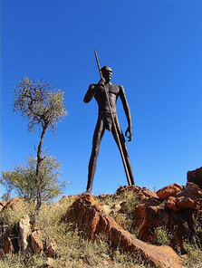
The Big Anmatjere Man lays within the Anmatjere Community, at the Aileron Roadhouse, around 150 kilometers north of Alice Springs.
He is 17 metres tall and weighs approximately 8 tonnes. It was completed in 2005. |
|
|
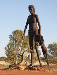
The Big Anmatjere Woman and Child is also in the Anmatjere Community, at the Aileron Roadhouse.
This was completed in 2008, after the women of the community asked for a female statue to go along with the Big Anmatjere Man. |
|
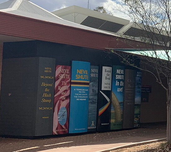
The Big Books are located in Alice Springs.
The Big Books were constructed in 2018 during a library renovation project. The Big Books are a set of eight giant books standing against the wall on one side of the library’s building. |
|
|
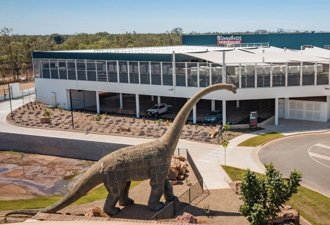
The Big Dinosaur is located in Yarrawonga and was built in 2007.
He is actually a Brontosaurus that locals have named ‘Big Kev’. They have a sentimental attachment to it. The Big Dinosaur that formerly stood outside Finlay’s landscaping supplies store in Darwin, Yarrawonga, is now located along Pierssene Road, outside one of the Bunnings warehouse outlets. |
|
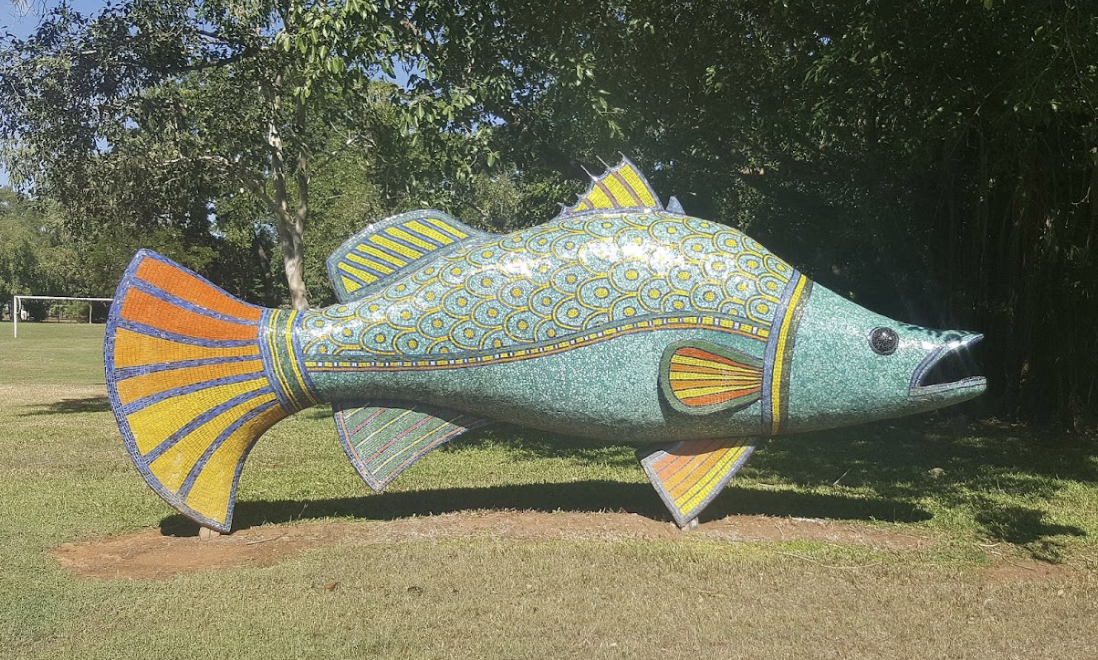
The Big Fish is located in
Wanguri at the Wanguri Preschool. The completed job was unveiled in 2010. The enormous barramundi was a thoughtful idea to celebrate and educate the learners about the local Larrakia and Wanguri people. These two communities had a rich culture and a strong relationship with the sea. In fact, the Larrakia people are referred to as the “Saltwater People“. |
|
|
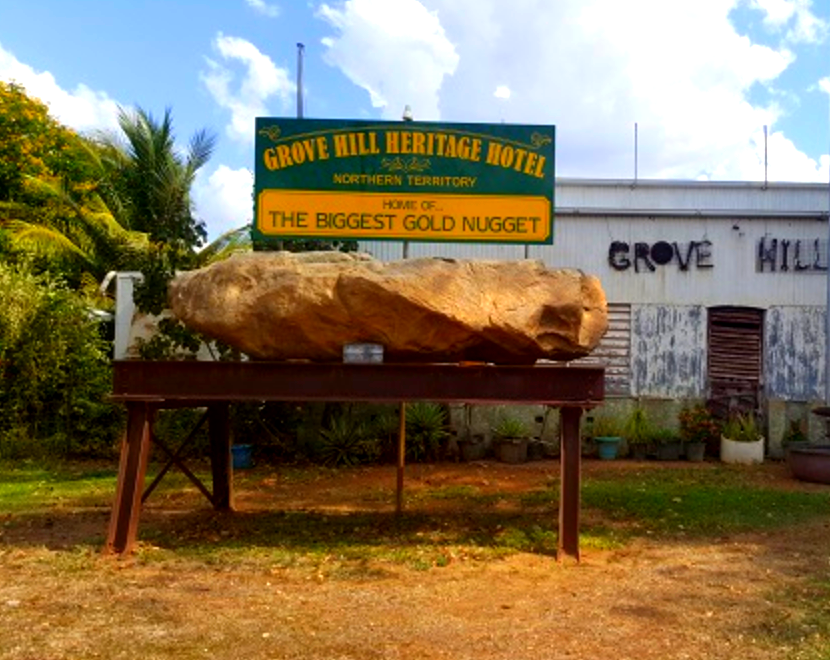
The Big Gold Nugget is outside the historic Grove Hill Heritage Hotel and Museum in Douglas-Daly, Northern Territory. The hotel and museum was built in 1934 and shortly after the nugget was seen (exact date unknown).
The nugget was built to represent the gold found in and around the town. In Grove Hill, Harry Roberts discovered gold during the construction of Overland Telegraph in 1872. |
|
The Big Hand is located in Alice Springs. The sculpture appeared about 2018 according to photos of the shop. It is located outside Central Second Hand Shop.The Big Hand is a sculpture of an enormous hand emerging from the ground with another smaller hand protruding from its index finger. |

|
|
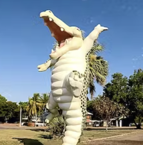
The Big Jumping Croc is located at Wak Wak. It is outside The Original Adelaide River Queen Jumping Crocodile Cruises. Created 1984 |
|
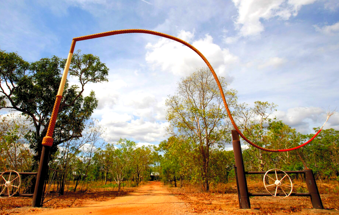
The Big Stockwhip is located at Mick’s Whips and Leather Goods' entrance in Acacia, Northern Territory.
The gigantic stockwhip is made of steel, standing 7 metres off the ground and measures 25 metres in length. The whip was made in 1988 or later (exact date unknown). |
|
|
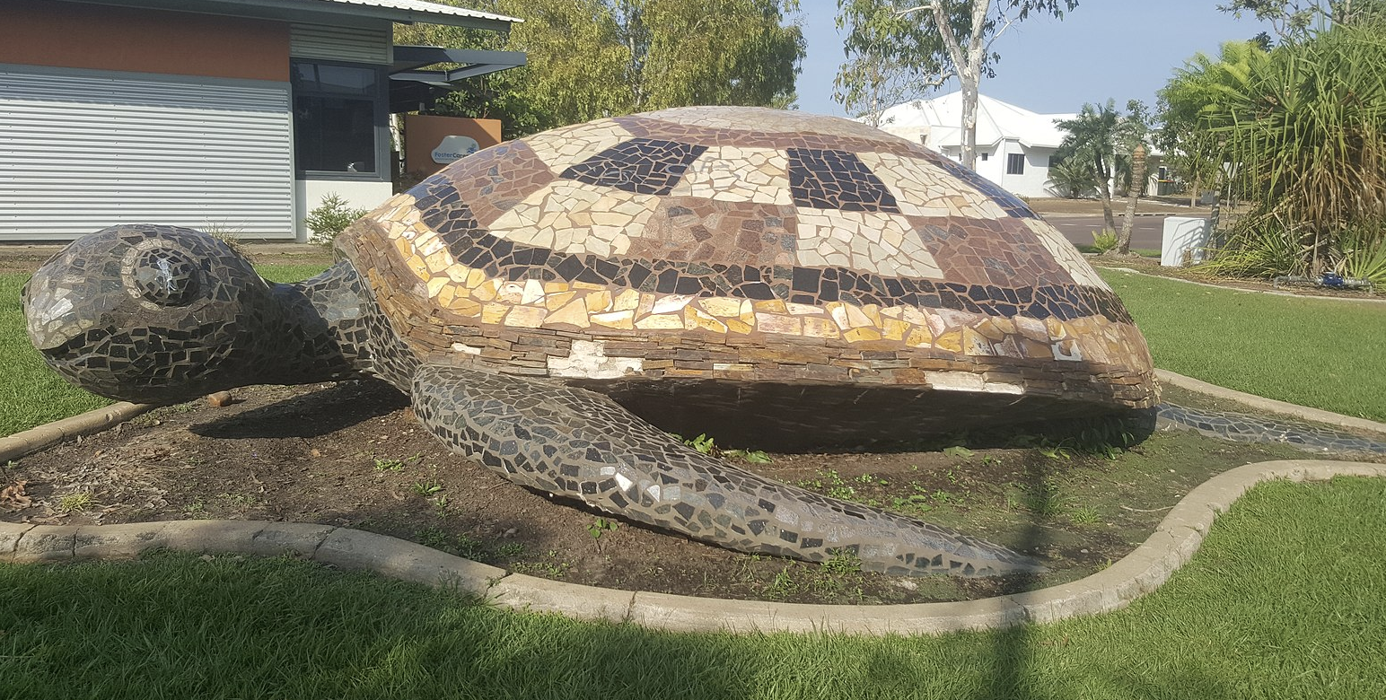
The Big Turtle is located at Lyons.
It was commissioned to celebrate the new estate of Lyons, which was established in 2004. It is a giant sea turtle and covered in mosaic tiles. |
|
The Big Frogs are located Ramada Suites by Wyndham Zen Quarters in Darwin. The BIG frogs have a sister pair, colourfully painted located within the Berry Springs Wildlife Park which has become more well known.
The Berry Springs Nature Park is home to many different types of frogs. |
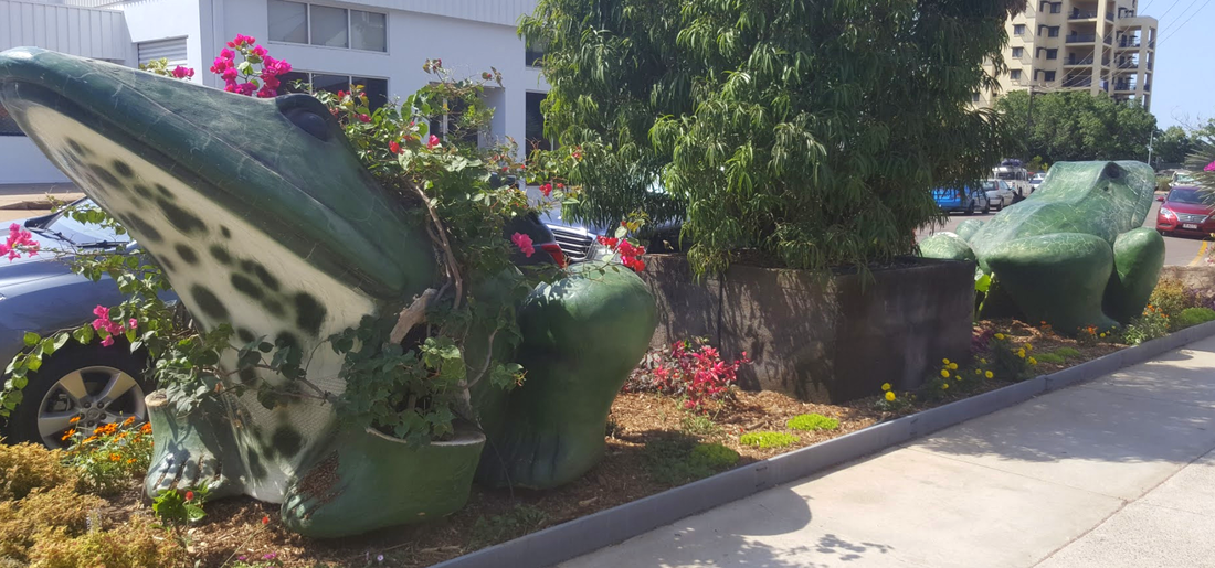
Big Frogs at Ramada Suites
|
5. Kakadu National Park
|
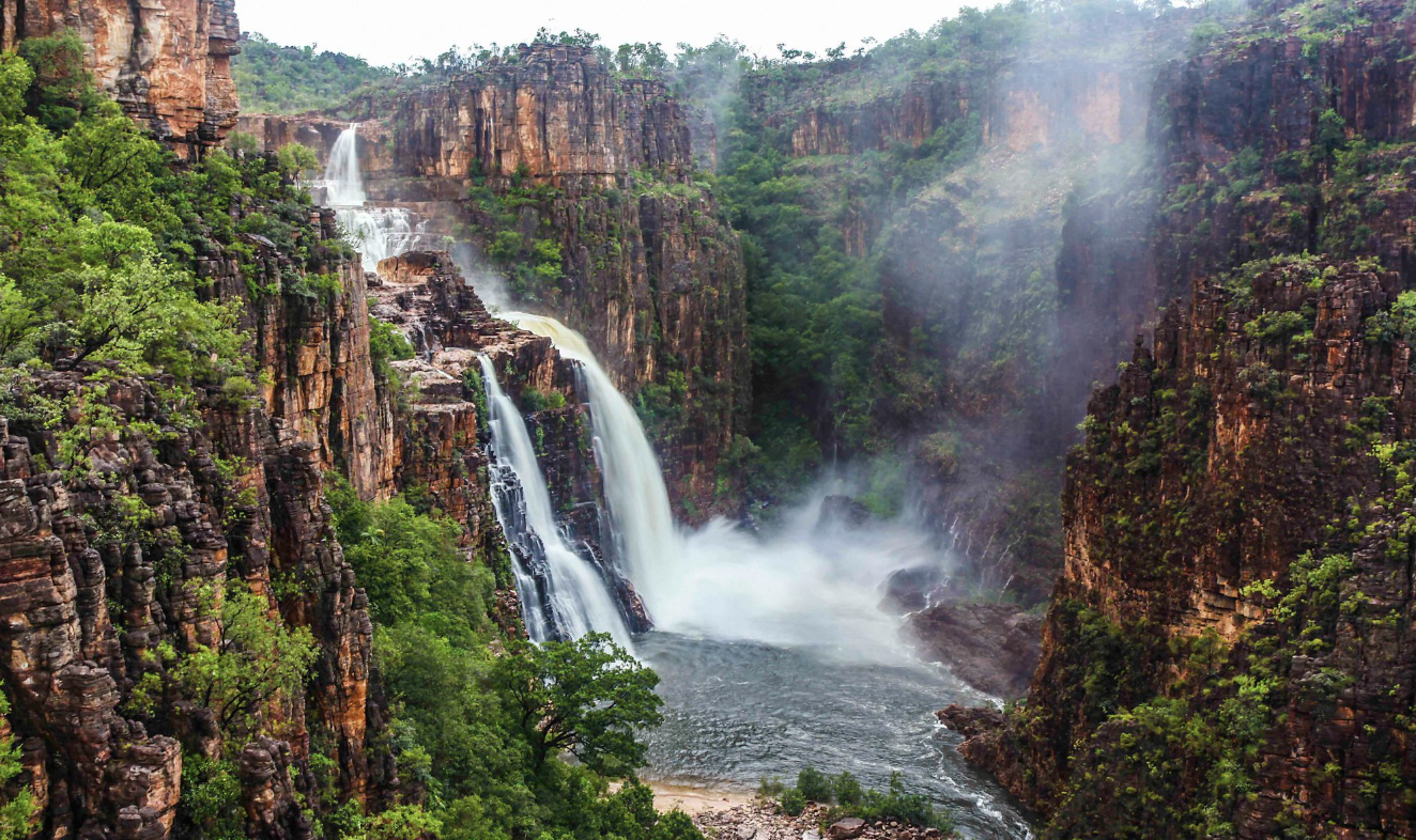
Kakadu National Park is located 240km east of Darwin in Australia's Northern Territory. It is a World Heritage-listed national park.
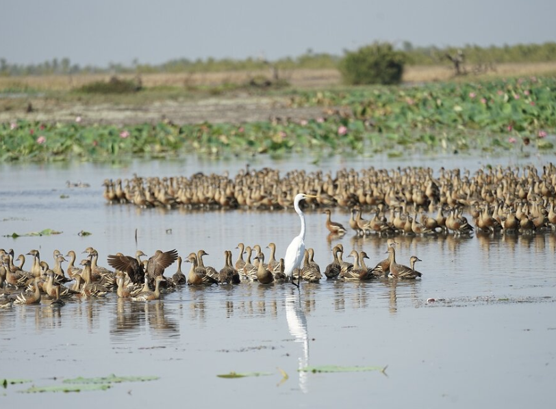
Kakadu is almost 20 000 square kilometres in size. That's a third the size of Tasmania. Kakadu is home to 2000 plant species, saltwater crocodiles, flatback turtles, exotic bird life, cascading waterfalls and Aboriginal paintings. Animal Life
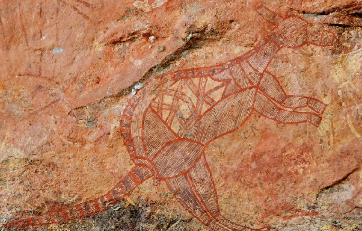
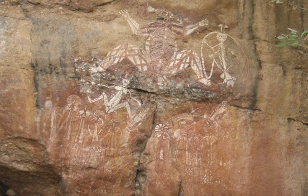
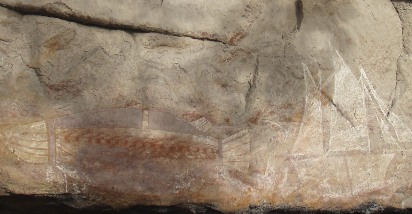
The Aboriginal people are the traditional owners of Kakadu National Park. Kakadu has been home to Aboriginal people for more than 50,000 years. The Aboriginal people of Kakadu are called Bininj in the north of the park and Mungguy in the south. Some live in Kakadu's towns and others live much further away in the park. The Australian land and its original people have always been linked. Caring for the land and its wildlife is the foundation of Aboriginal People’s culture. Rock Art Kakadu is home to many forms of rock art and this represents one of the oldest historical records of any culture of people in the history of the world. This is one of the reasons Kakadu received World Heritage status, to protect these important records of history. The paintings provide a fascinating record of Aboriginal life over thousands of years. Some of the paintings are up to 20,000 years old, which make it one of the longest historical records of any culture in the world. Tourism Visitors to Kakadu National Park can observe birds, fish, hike, tour with a ranger, swim, visit the waterfalls and observe paintings. |
|
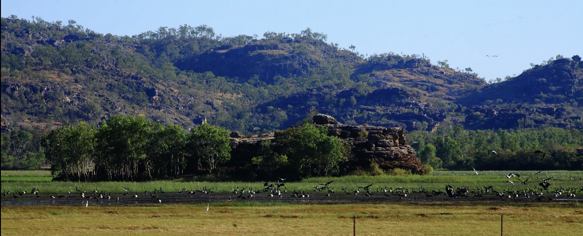
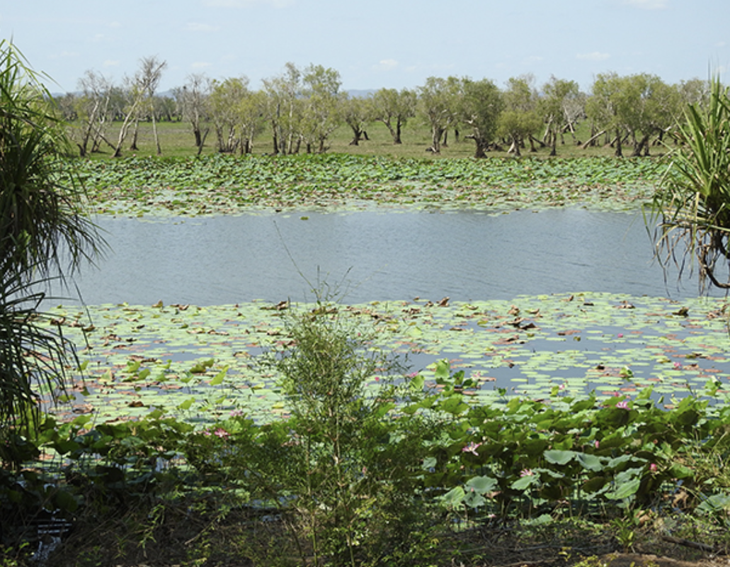
Wetland just outside Kakadu
6. Uluru
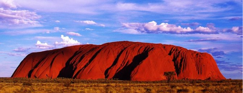
Uluru is one of Australia’s most recognisable landmarks. It is located in the Uluru-Kata Tjuta National Park and is listed as a World Heritage Site by UNESCO.
Uluru is one of the largest single rock monoliths, upright block of stone, in the world.
It was created around 600 million years ago.
Geologists refer to Uluru as an inselberg which means “island mountain”.
The summit of Uluru is relatively flat. The surface is made up of valleys, caves, ridges and gullies that have been created over millions of years due to erosion from the wind and rain.
Uluru is the Aboriginal People's official name for the rock, but it has also been known as Ayers Rock for a time. It was named this after Sir Henry Ayers, the eighth premier of South Australia.
Uluru is sacred to the Anangu people, who have requested for a long time that visitors respect their culture by not climbing the rock. There was also concern about the difficulty and danger of the climb, and the safety of tourists. There have been 37 deaths of climbers on Uluru. In November 2017, the Uluṟu–Kata Tjuṯa National Park board voted to prohibit climbing Uluru, and the last people allowed to climb did so in October 2019.
Uluru is…
- 348m high
- extends about 2.5km into the ground
- 863m above sea level
- 3.6km long
- 1.9km wide
- 9.4km around the base
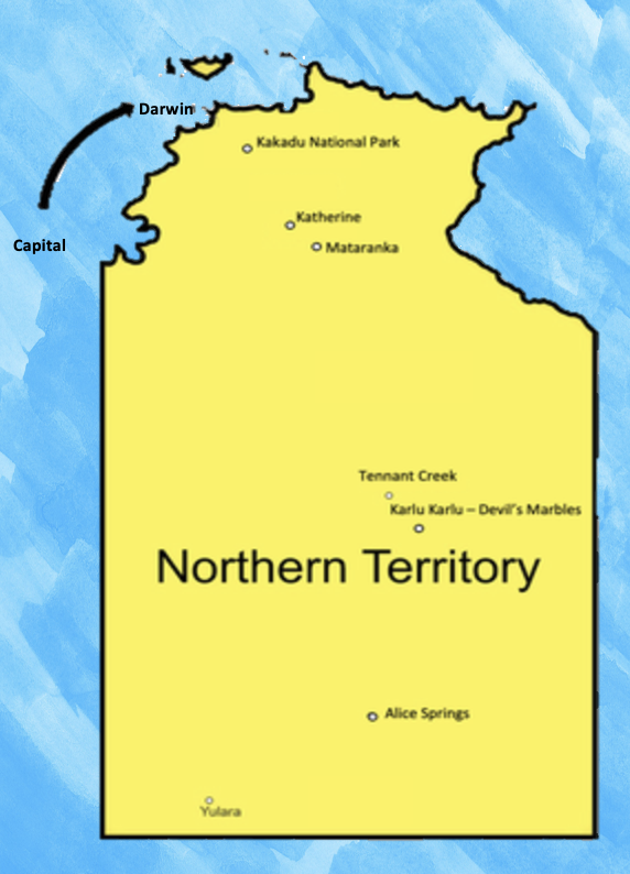
7. Darwin
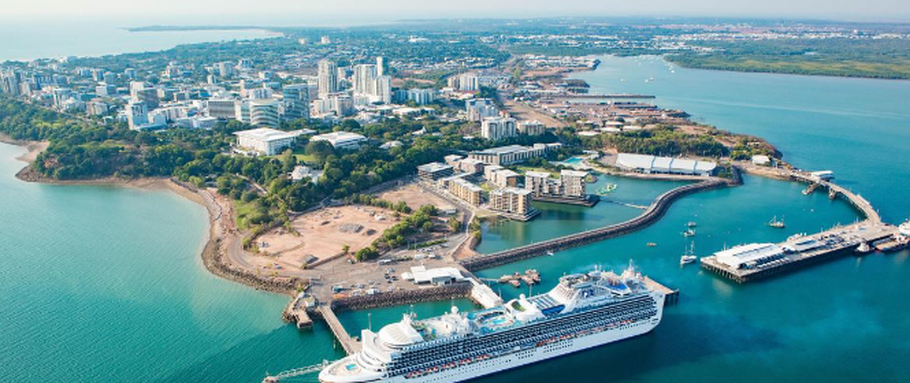
Interesting Facts About Darwin
- Darwin is the capital city of the Northern Territory
- Darwin is located on coast of the Timor Sea
- The city has been rebuilt four times – three times due to cyclones and once after World War II bombings.
- Over 130 000 people live in Darwin.
- Darwin is the closest Australian capital city to Asia.
- Saltwater crocodiles are found in waterways all around Darwin.
- Darwin holds an annual Beer Can Regatta, where locals build boats out of cans and bottles and try to float them on water.
Things to See and Do in Darwin
- Darwin Waterfront Precinct is located in the heart of Darwin’s CBD. You can wander around the parklands and view public art or bring a picnic blanket and relax beside the waterfront!
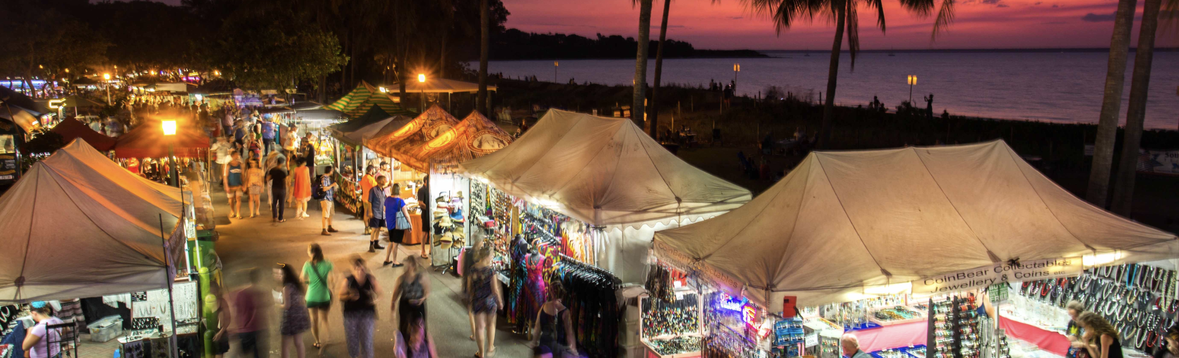
- Mindil Beach is the best for a photo of the sun setting onto the horizon. Mindil Beach is well known for its dazzling sunset views. You can take a boat cruise from the beach.
- Shop at the Mindil Beach Sunset Markets If you visit Darwin between April and October, you can check out the sunset markets. Over 200 stalls can be found at these markets, featuring local arts, crafts and delicious food.
- Nightcliff Jetty is another fantastic place for sunset views. With bike tracks around the Nightcliff Foreshore is also a great place to go for a picturesque bike ride.
- George Brown Darwin Botanic Gardens Just two kilometres north of the city, these gardens have 42 hectares of natural beauty. Notable attractions include a Madagascan Garden, a beautiful rainforest waterfall and Darwin’s biggest ornamental fountain.
- Darwin Military Museum Darwin’s military history can be discovered at this museum. Founded in the 1960’s, this treasure trove features gems of history such as a gun emplacement, military vehicles and weapons.
- Fannie Bay Gaol was built over 100 years ago. It features several historical buildings, including prison blocks and gallows.
- Ride the Wave Lagoon to beat the summer heat or just a swim at the Wave Lagoon. It's located in the Darwin Waterfront and features ten different wave patterns which reach up to 1.2 metres high.
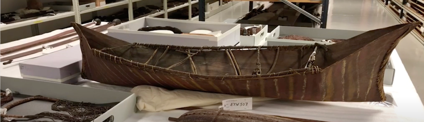
Artifacts from the Larrakia Peoples
History of Darwin
The Larrakia Peoples are the Traditional Owners of the land Darwin was founded on. They have lived there for over 65000 years.
The first European settlers to find Darwin were on the HMS Beagle. The captain of the ship, John Clements Wickham, named the area ‘Port Darwin after the famous naturalist Charles Darwin.
Darwin has been through many trials and tribulations, from being bombed in World War II to the devastation of Cyclone Tracy, but it continues to stand strong to this day.
8. seasons in Kadadu National Park
|
At least one third of the Park is managed by the Aboriginal communities who are still practising traditional ways of life.
There are six seasons on the calendar and each one represents an important event in Kakadu's WET and DRY seasons. The way the flora (plants) and fauna (animals) coexist tells the community when the seasons are changing, about weather patterns and how to harvest and protect the land. The Aboriginal Peoples use animals and plants to help them know when the weather changes. |
Nauiyu (Daly River): Indigenous seasonal calendars on Many ...
YouTube·CSIRO·30 May 2022 This is not Kakadu but they observe a similar calendar and is well worth watching. Certain animals and plants can help the community identify key events in the weather and to plan their lives according to those changes |
|
Wet Seasons
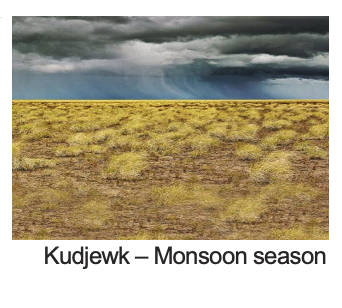
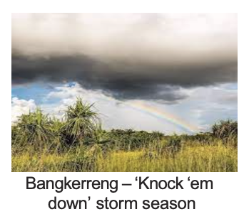
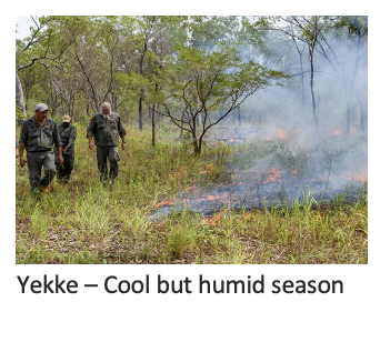
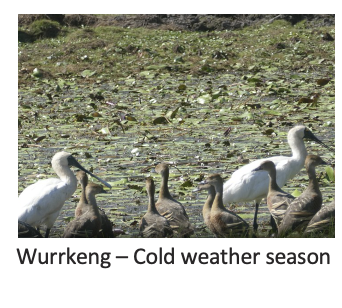
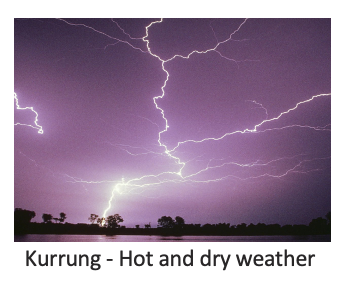
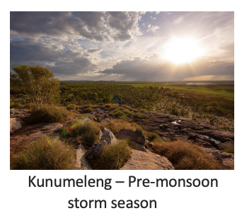
Kudjewk – Monsoon season December to March. 24°C – 34°C This is the true tropical summer – thunderstorms, heavy rain and flooding. Kudjewk’s heat and humidity cause an explosion of plant and animal life. Speargrass grows to over two metres tall and gives the woodlands a silvery-green hue. Magpie geese nest in the wetlands while widespread flooding drives goannas, snakes and rats to seek refuge in the trees. Eggs and stranded animals are a good source of food for local Aboriginal people during this time. Bangkerreng – ‘Knock ‘em down’ storm season April. 23°C – 34°C By April, the rain clouds have dispersed and there are clear skies. The vast expanses of floodwater recede and streams start to run clear again. Most of Kakadu’s plants are fruiting and animals are caring for their young. The early days of bangkerreng are marked by violent, windy storms that flatten the speargrass – these are called ‘knock ‘em down’ storms. Yekke – Cooler (but still humid) season May to mid-June. 21°C – 33°C This is a relatively cool time with less humidity. Early-morning mists hang low over the plains and the shallow wetlands and billabongs are carpeted with water lilies. Dry winds and flowering Darwin woollybutt tell local Aboriginal people that it’s time to start patch burning to ‘clean the country’ and encourage new growth. Dry Seasons Wurrkeng – Cold weather season Mid-June to mid-August. 17°C – 32°C This is the cold time – at least by Northern Territory standards. Humidity is low, while daytime temperatures are around 30°C and drop to about 17°C at night. Most creeks stop flowing in Wurrkeng and the floodplains quickly dry out. The Bininj/Mungguy continue patch burning, which is extinguished by the dew at night. Birds of prey patrol the fire lines during the day as insects and small animals escape the flames. Magpie geese, fat and heavy after weeks of abundant food, crowd the shrinking billabongs with a myriad of other waterbirds. Kurrung – Hot dry weather Mid-August to mid-October. 23°C – 37°C Kurrung is hot and dry. It is still ‘goose time’ but also time for local Aboriginal people to hunt file snakes and long-necked turtles. Sea turtles lay their eggs on the sandy beaches of Field Island and West Alligator Head, where goannas sometimes rob the nests. White-breasted wood swallows arrive as the thunderclouds start to build. Kunumeleng – Pre-monsoon storm season Mid-October to late December. 24°C – 37°C Kunumeleng is the pre-monsoon season, with hot weather that becomes increasingly humid. It can last from a few weeks to several months. Thunderstorms build in the afternoons and showers bring green to the dry land. As the streams begin to run, acidic water from the floodplains can kill fish in billabongs with low oxygen levels. Barramundi move from the waterholes to the estuaries to breed, and waterbirds spread out with the increased surface water and plant growth. Kunumeleng was when Aboriginal people traditionally moved camp from the floodplains to the stone country to shelter from the coming monsoon. |
|
9. Animals of the Northern Territory
Saltwater Crocodile
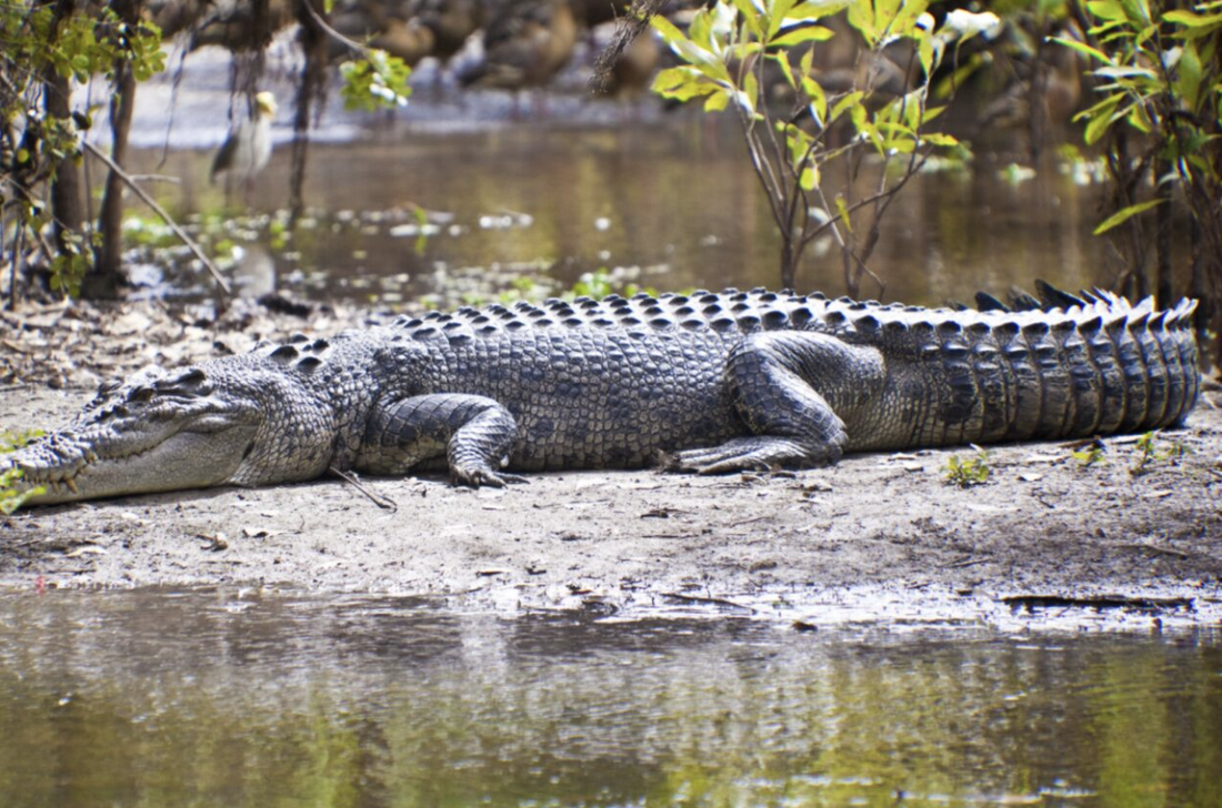
Crocodiles have been around for 240 million years. Crocodiles have highly developed vision, hearing and sense of smell. Because they are cold blooded, to regulate their body temperature they move in and out of water, basking on land, shade seeking and mouth gaping. Although they spend large amounts of time motionless, they are alert watching their environment. Saltwater crocodiles can grow up to 7m and weigh as much as 1,000 kg. Females are much smaller, rarely growing to over 3m in length. In the wild, Saltwater crocodiles can live for more than 70 years. An estimated 100,000 saltwater crocodiles live in the Northern Territory. Saltwater crocodiles mostly eat fish, but will eat almost anything that they can overpower which can include turtles, goannas, snakes, birds, cattle, buffalo, wild boar and mud crabs. Hatchlings and juvenile crocodiles feed on insects, crustaceans, small reptiles, frogs and small fish. Their extremely powerful jaws are responsible for creating the strongest bite in the animal world. |
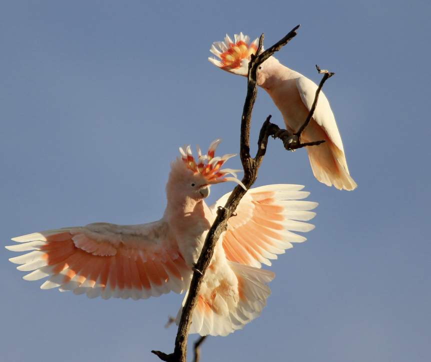
Major Mitchell Cockatoo
They weigh between 300- 500g and are 40 - 60cm long. This cockatoo has a pink and white body with a long white crest that has colourful band of red at base. In flight, you can see pink under their wings. Major Mitchell Cockatoos are omnivores, eating fruits, nuts, roots, plant seeds and bulbs, but also insects. They will often be found feeding on the ground. They use their claws for both holding onto their food and for climbing. They have very strong beaks to help them crack open hard seed and nuts as well has breaking tree bark. Their distinctive “creek-ery-cree” call can be heard for extremely long distances. |
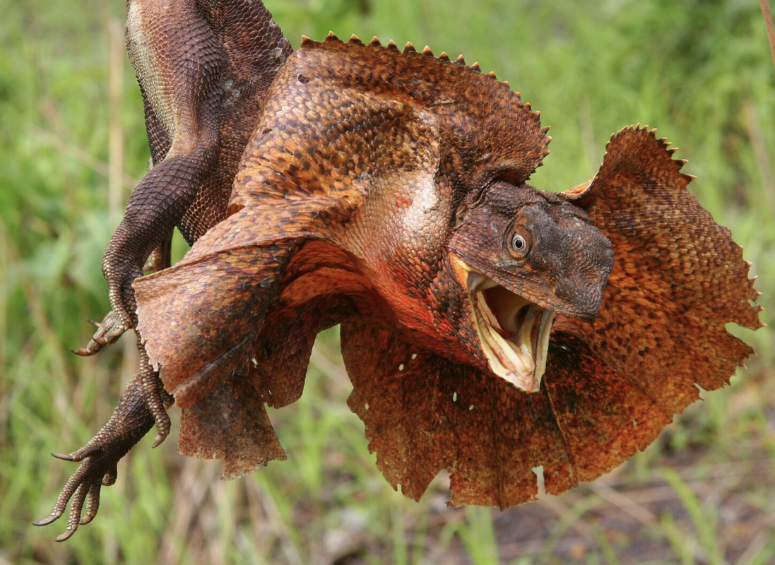
Frilled-Neck LizardThe frill-necked lizard grows to around 45-90cm in length, about two-thirds of which is tail. It has a vivid yellow mouth and a large extendible frill gathered about the neck and under throat.
The combination of the gaping mouth and the wide, brightly coloured frill is an intimidating sight to predators. It frequently runs at speed on two legs to escape danger, quickly climbing the nearest tree to safety. Their colour can be brown or grey with the frill being lighter and often tinged with orange or reddish-brown. Males are bigger than females and have a more robust appearance. There are two long, pointed canine-like teeth present in the lower jaw, which can give a painful bite. Frilled lizards live dry woodland, usually with an open shrubby or grass under-storey. Most of the time they spend off the ground in trees. They are well adapted to life in the hot tropics of north-western and northern Australia and the species. The frilled lizard eats mainly insects, spiders and other invertebrates, although small mammals and reptiles are also taken occasionally. The frilled lizard lays between 8-14 eggs which are laid at the beginning of the wet season. Hatchlings are fully self-sufficient and are only too willing to use the frill and gaping mouth display when they feel threatened. |
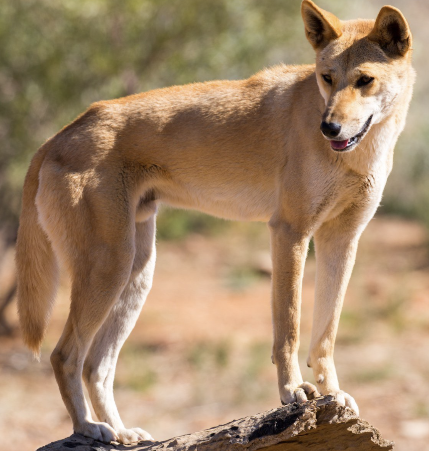
Dingo
Dingoes came to Australia about 40,000 years ago. They are related to the Grey Wolf of Asia. Because it is more like a wolf than a dog, dingoes don’t bark, they howl. Aboriginal peoples kept dingoes in their camps and the dogs hunted with the men. Dingoes are about 50 centimetres tall and about 120 centimetres long with a bushy tail and pointed ears. Most dingoes have coats of short yellow -brown hair but there are cream-coloured dingos as well as black and tan. Dingoes are carnivores, meaning they only eat meat. They will eat rabbits, wombats, wallabies and kangaroos. They hunt mainly at night. |
10. National Parks
|
Watarrka National Park
Watarrka National Park includes the western end of the George Gill Range. This scenic landscape of rugged ranges, rockholes and gorges act as a refuge for many plants and animals. The ancient red canyon walls soar 100m above Kings Creek to a plateau of rocky domes. Commonly called 'the Garden of Eden', the sheltered creek environments below protect an abundance of flora including the MacDonnell Ranges Cycad. Kathleen Springs is located 21km by road from Kings Canyon. The relics of old stockyards can be seen along the pleasant walk to the permanent waterhole. The waterhole holds special significance for the local Aboriginal people and is important for wildlife, so swimming is not permitted. |
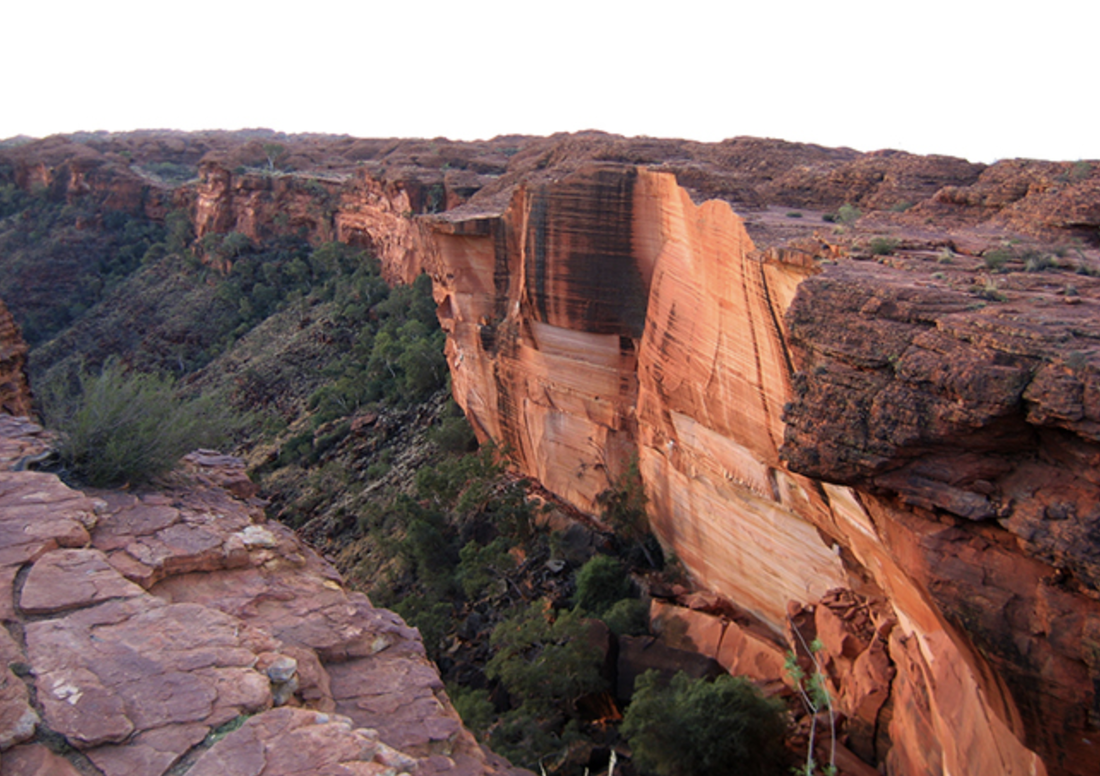
King's Canyon
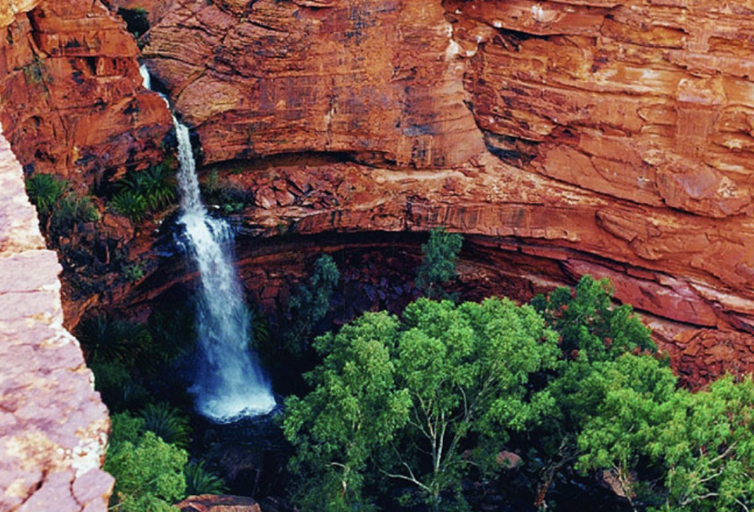
"the Garden of Eden"
|
|
Mary River National Park
Apart from spectacular fishing, Mary River is popular for four-wheel driving, bushwalking and birdwatching. It's a must-see park for any nature lover. Photographers can get great wildlife and landscape shots with an abundance of native birdlife and saltwater crocodiles against a backdrop of paperbark swamp and lotus lilies. There is a large population of saltwater crocodiles throughout the park, particularly at Shady Camp. Bring plenty of protective clothing and insect repellent. |
|
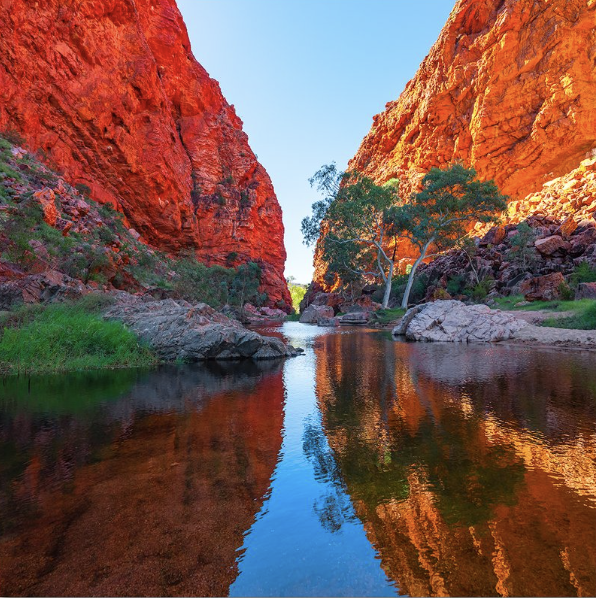
Tjoritja / West MacDonnell National Park
The Aranda people refer to the West MacDonnell Ranges as Tjoritja (pronounced Choor-it-ja). In their lore and culture, the landscape was created by ancestral beings during a mythological time, the foundation of their spiritual beliefs and identity. The park is located west of Alice Springs and stretches 161km. It's home to threatened species including the central rock-rat and long-tailed dunnart as well as other species like the black-footed rock-wallaby and MacDonnell Ranges cycad. Some of the sites you shouldn't miss on a journey here include Simpsons Gap, Ochre Pits, Standley Chasm and the permanent waterholes at Ellery Creek Big Hole, Ormiston Gorge and Glen Helen. 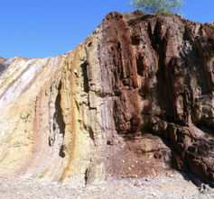
Ochre Pits
|
Simpson's Gap
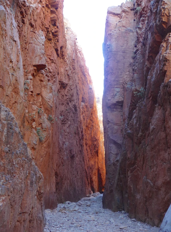
Standley Chasm
|
Garig Gunak Barlu National Park
Cobourg Peninsula
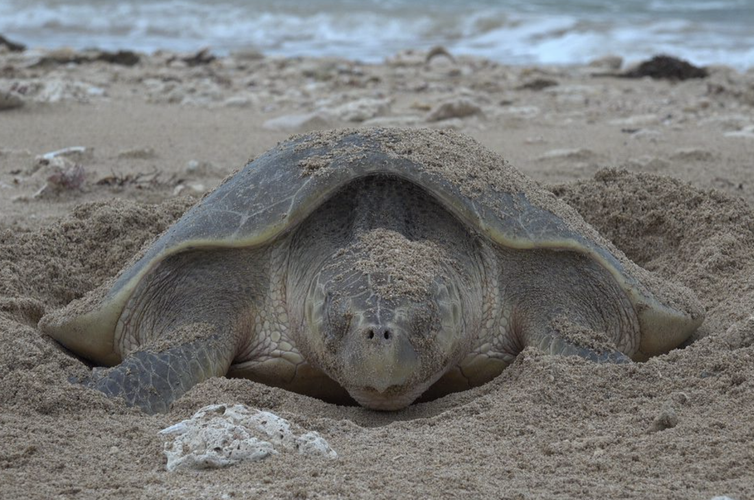
Turtle
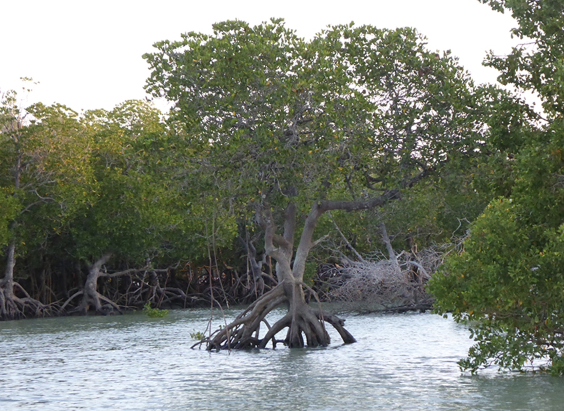
Mangroves
|
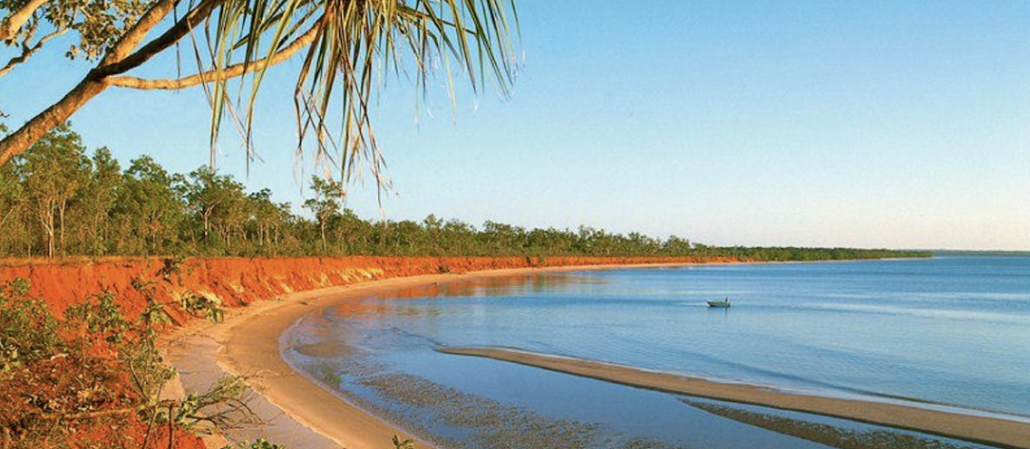
At the very top of the Northern Territory in Arnhem Land on the Cobourg Peninsula, you will find Garig Gunak Barlu National Park. It is remote and rugged, fringed with magnificent white sandy beaches.
This park includes the entire Peninsula, the surrounding waters of the Arafura Sea and Van Diemen Gulf, and some of the neighbouring islands. Discover:
At Black Point Cultural Centre to see the display of Aboriginal, Macassan and European histories of the area. Explore the eerie ruins of the failed Victoria Settlement by boat. Tourist can access the park via air, sea or an unsealed road (four-wheel drive only). |
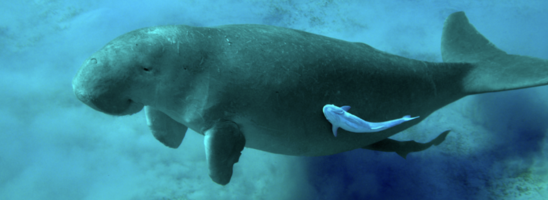
With seagrass you find dugongs and turtles.
Activities
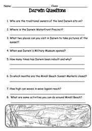
Darwin Questions.
1. Download and print the worksheet. 2. Go to section 7 on the webpage for your answers. |
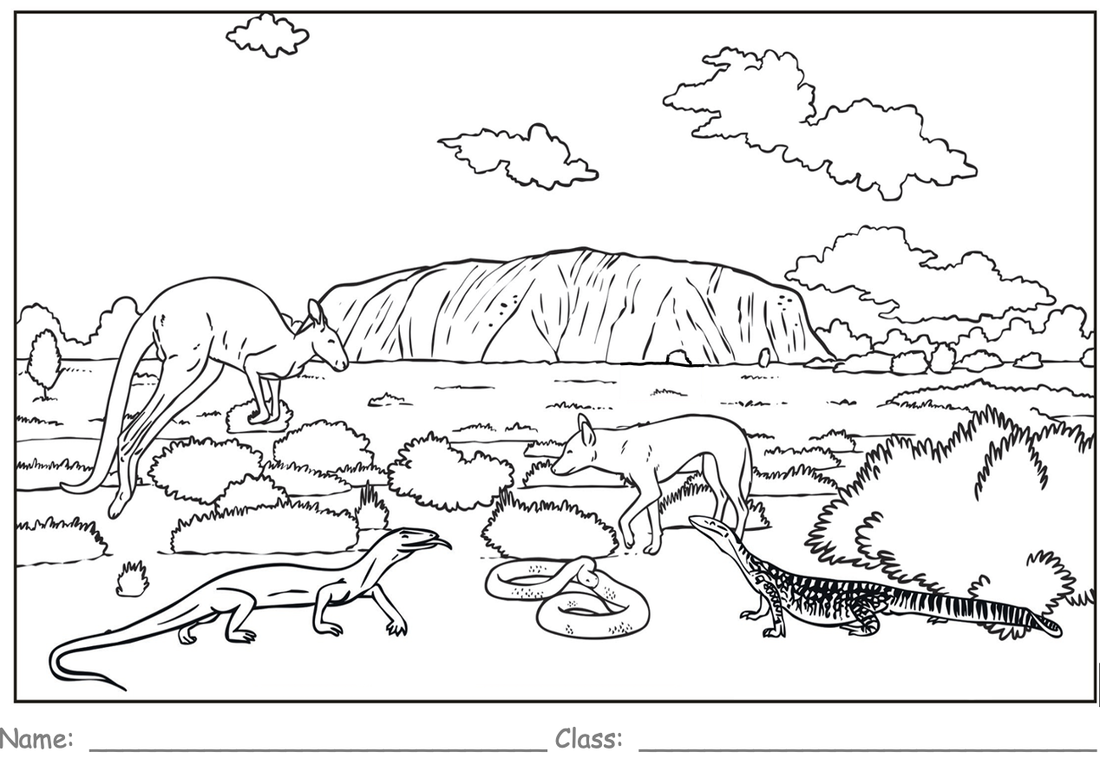
Colour Fun
1. Download the worksheet and print to the library printer. 2. Have fun colouring the picture. |
MAKE a TIMELINE
1. Re-read Section 4. Big Things. 2. Make notes in your exercise book of 5 big things and when they were created. 3. Construct a timeline in your book. |
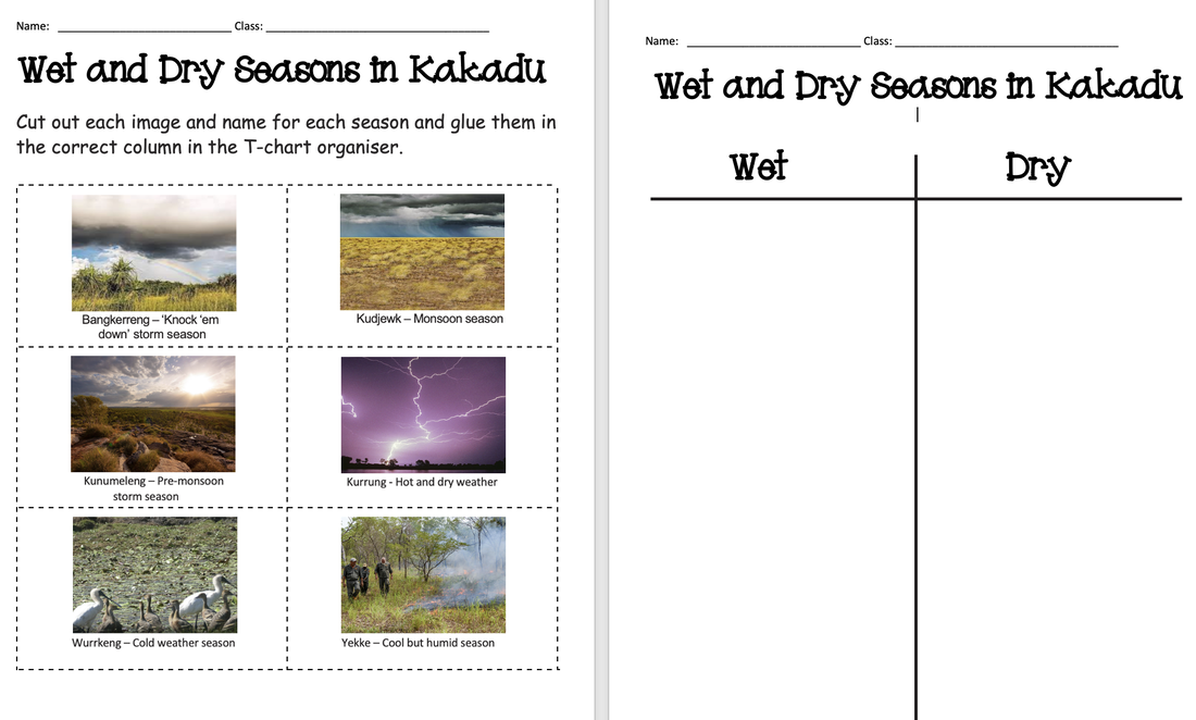
Aboriginal Seasons
1. Download the worksheet and print to the library [rinter. 2. Read section 8. Seasons in Kadadu National Park. 3. Using this in formation, cut out the pictures and glue them to the second page of the worksheet according to whether they belong in the Wet or Dry season. |
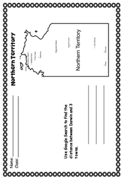
Distances in the NT
1. Download the worksheet and print to the library printer. 2. Look at the map and choose 3 towns. 3. Using Google search find the distance between each of the 3 towns and Darwin - e.g. Darwin to Tennant Creek. 4. Record your answers. |
Notes to Sentences
1. Download the worksheet and print to the library printer. 2. Choose 3 notes and write them in sentences. |
Find a Word
If you enjoy find a words, try this one. 1. Download the worksheet and print to the library printer. 2. Highlight the words as you find them. |
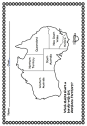
Map Reading
1. Download the worksheet and print to the library printer. 2. Find the Northern Territory 3. Colour the states that share a border with the Northern Territory. |
